Outer Sunset Traffic Management Project

Outer Sunset Traffic Calming Project Completed On Time!

SFMTA worked in partnership with the Recreation and Park Department to develop and implement a comprehensive and integrated traffic calming strategy that responds to the concerns that we heard from residents of the Outer Sunset. In early February 2021, funding for the SFMTA traffic calming strategy was approved by the San Francisco County Transportation Authority.  The traffic calming measures were completed on time in April 2021 and address community concerns related to changing traffic patterns during the time that the Upper Great Highway was fully closed to vehicular traffic during the COVID-19 pandemic.

Project Introduction

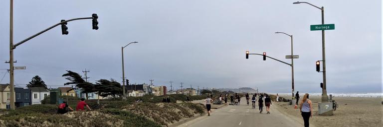
In April 2020, as part of the city’s COVID-19 response efforts, San Francisco temporarily repurposed the Upper Great Highway to be a car-free street that prioritizes families, people on bicycles and pedestrians. The change in use of the roadway has created an unrivaled and scenic public space and coastal promenade for thousands of people of every age, race and gender to have expanded opportunities for physically distanced recreation and essential trips during the COVID-19 pandemic. 

SFMTA took actions to improve the safety conditions for those affected by the roadway changes. In 2020, the SFMTA installed signs, traffic delineators, speed tables and other measures at over 20 locations in the Outer Sunset to manage traffic on local streets and redirect traffic to routes such as 19th Avenue and Sunset Boulevard. 

Map of traffic management tools: at southbound Upper Great Highway and Lincoln, “Road closed” and “Detour” signs; at southbound Lower Great Highway and Lincoln, white delineators; at eastbound Lower Great Highway and Lincoln, “No Right Turn” sign; at southbound Upper Great Highway and Lincoln, “Detour on Left” sign; at eastbound Lincoln at La Playa and MLK Jr. Drive, “No Right Turn” sign; at southbound Lincoln at La Playa and MLK Jr. Drive, “Road Closed to Through Traffic” signs; at eastbound Lincoln and 37th Avenue, “Detour on Right” sign; at eastbound Lincoln and 41st Avenue, “Detour straight ahead” sign; at eastbound Lincoln and 45th Avenue, “Detour straight ahead” sign; at southbound Lincoln and 48th Avenue, “Road Closed the Through Traffic” signs; at eastbound Lincoln and La Playa, “Detour straight ahead” sign; at northbound Skyline Boulevard, three “Great Highway Closed / Used Sunset Boulevard straight ahead” signs; at eastbound Sloat and 47th Avenue, two “No Left or U-Turn” signs and yellow safe-hit posts; at Lower Great Highway and Irving, speed table; at Lower Great Highway and Ortega, speed table; at Lower Great Highway and Santiago, speed table; at Lower Great Highway and Ulloa, speed table.

Map of traffic management tools in phase 2 of the traffic management program. 24 speed cushions, 1 speed table, and 12 stop signs will be installed at intersections along Lower Great Highway, 46th 27th and 48th Avenues, and La Playa.

Map of changeable message signs along Sloat, Lincoln, and Fulton that will advise motorists to use alternative routes. Also shown are recommended alternative routes to Great Highway, which is closed to vehicles during the shelter-in-place order. From north to, alternative routes include, Great Highway, Park Presidio Boulevard, Crossover Drive, Lincoln Way, Sunset Boulevard, 19th Avenue, Sloat Boulevard, and Skyline Boulevard. Please follow all traffic laws and regulations.


Project Information 

The goal of the Outer Sunset Traffic Management Project is to increase safety for all members of the public by implementing immediate and medium-term traffic management improvements. The project addressed community concerns related to changing traffic patterns during the time that the Upper Great Highway is being used by families, bicyclists, and pedestrians during the COVID-19 pandemic. 

The work included collecting traffic speed and volume data, evaluating current safety and traffic conditions, using traffic management tools such as signs and traffic diverters to manage traffic and improve safety, as well as identifying street and network changes that could complement future uses of the Great Highway. 


Construction crews pour asphalt for a speed hump on Lower Great Highway.


Related Projects

Project Timeline
Summer 2020 through Winter 2021
Community outreach, data collection/evaluation, installation of traffic management tools
Completed
Winter 2021
Project completion
Completed
Project Status
  1. Completed
Project Success
On budget
On schedule
Improvements
walking
Pedestrian improvements
bike
Bicycle improvements
SFMTA Drive and Parking icon
Traffic safety improvements (including signs, speed tables, and traffic diverters)
Streets
Upper Great Highway, Lower Great Highway, Lincoln Way, Sloat Boulevard, Sunset Boulevard
San Francisco County Transportation Authority logo
San Francisco Public Works logo
San Francisco Recreation and Parks logo