Great Highway and Outer Sunset Traffic Management Project

Update to Great Highway Pilot project 

On December 6, 2022, the San Francisco Board of Supervisors passed an ordinance to maintain the Great Highway between Lincoln Way and Sloat Boulevard as a car-free promenade until Dec. 31, 2025, allowing for a three-year pilot study. This would preserve the current schedule of closing the road to motor vehicle traffic on weekends beginning on Friday afternoons at 12 p.m. until Monday mornings at 6:00 a.m. and on holidays. The pilot would allow the Recreation and Park Department and SFMTA to collect more robust data on the Great Highway’s use as both a roadway and a promenade, as well as gather additional public feedback. We would report our findings every six months to internal and external stakeholders. Ultimately, this thorough research will be used to make a recommendation to the Board of Supervisors for consideration on the Great Highway’s long-term future. For more information, visit Rec and Park Great Highway Pilot and SFMTA Great Highway Pilot Evaluation Project .

프로젝트 소개 (Project Introduction)


Background: Car-free Upper Great Highway

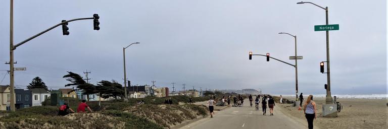
In April 2020, as part of the city’s COVID-19 response efforts, San Francisco temporarily repurposed the Upper Great Highway to be a car-free street that prioritizes families, people on bicycles and pedestrians. The change in use of the roadway has created an unrivaled and scenic public space and coastal promenade for thousands of people of every age, race and gender to have expanded opportunities for physically distanced recreation and essential trips during the COVID-19 pandemic. 

While this coastal promenade  is in place, the SFMTA is taking actions to improve the safety conditions for those affected by the changes. In 2020, the SFMTA installed signs, traffic delineators, speed tables and other measures at over 20 locations in the Outer Sunset to manage traffic on local streets and redirect traffic to routes such as 19th Avenue and Sunset Boulevard. The SFMTA also plans to collect additional data to improve our understanding of the dynamic roadway conditions and traffic patterns.

Map of traffic management tools: at southbound Upper Great Highway and Lincoln, “Road closed” and “Detour” signs; at southbound Lower Great Highway and Lincoln, white delineators; at eastbound Lower Great Highway and Lincoln, “No Right Turn” sign; at southbound Upper Great Highway and Lincoln, “Detour on Left” sign; at eastbound Lincoln at La Playa and MLK Jr. Drive, “No Right Turn” sign; at southbound Lincoln at La Playa and MLK Jr. Drive, “Road Closed to Through Traffic” signs; at eastbound Lincoln and 37th Avenue, “Detour on Right” sign; at eastbound Lincoln and 41st Avenue, “Detour straight ahead” sign; at eastbound Lincoln and 45th Avenue, “Detour straight ahead” sign; at southbound Lincoln and 48th Avenue, “Road Closed the Through Traffic” signs; at eastbound Lincoln and La Playa, “Detour straight ahead” sign; at northbound Skyline Boulevard, three “Great Highway Closed / Used Sunset Boulevard straight ahead” signs; at eastbound Sloat and 47th Avenue, two “No Left or U-Turn” signs and yellow safe-hit posts; at Lower Great Highway and Irving, speed table; at Lower Great Highway and Ortega, speed table; at Lower Great Highway and Santiago, speed table; at Lower Great Highway and Ulloa, speed table.

Map of traffic management tools in phase 2 of the traffic management program. 24 speed cushions, 1 speed table, and 12 stop signs will be installed at intersections along Lower Great Highway, 46th 27th and 48th Avenues, and La Playa.

Map of changeable message signs along Sloat, Lincoln, and Fulton that will advise motorists to use alternative routes. Also shown are recommended alternative routes to Great Highway, which is closed to vehicles during the shelter-in-place order. From north to, alternative routes include, Great Highway, Park Presidio Boulevard, Crossover Drive, Lincoln Way, Sunset Boulevard, 19th Avenue, Sloat Boulevard, and Skyline Boulevard. Please follow all traffic laws and regulations.

The SFMTA is also partnering with the San Francisco County Transportation Authority, San Francisco Public Works, and Recreation and Parks Department on the District 4 Mobility Study to explore the long-term future of the Great Highway.

Project Information 

The goal of the Great Highway and Outer Sunset Traffic Management Project is to increase safety for all members of the public by implementing immediate and medium-term traffic management improvements. The project addresses community concerns related to changing traffic patterns during the time that the Upper Great Highway is being used by families, bicyclists, and pedestrians during the COVID-19 pandemic. 

The work includes collecting traffic speed and volume data, evaluating current safety and traffic conditions, using traffic management tools such as signs and traffic diverters to manage traffic and improve safety, as well as identifying street and network changes that could complement future uses of the Great Highway. 

The SFMTA is working with residents, merchants, key stakeholders, and other city departments to address the traffic and safety impacts to the community as the city evaluates potential future uses of the Upper Great Highway. Please visit the District 4 Mobility Study webpage to learn more about the Study.

Great Highway Traffic Calming Project Completed On Time!

The Great Highway between Lincoln Way and Sloat Boulevard has been temporarily repurposed as a car-free coastal promenade. During that time, the SFMTA has worked in partnership with the Recreation and Park Department to develop and implement a comprehensive and integrated traffic calming strategy that responds to the concerns that we have heard from residents of the Outer Sunset and Richmond District. In early February 2021, funding for the SFMTA traffic calming strategy was approved by the San Francisco County Transportation Authority and crews have been working throughout the Outer Sunset to install stop signs, speed cushions and a speed table at strategic locations to help improve safety conditions and to direct traffic to surrounding streets such as Lincoln Way and Sunset Boulevard. The traffic calming measures were completed on time in April 2021 and address community concerns related to changing traffic patterns during the time that the Upper Great Highway is being used by families, bicyclists, and pedestrians during the COVID-19 pandemic.

Construction crews pour asphalt for a speed hump on Lower Great Highway.

On August 16, 2021 the Great Highway opened to vehicular traffic on Mondays at 6 a.m. through Fridays at 12 p.m. and opened to pedestrians and bicycles only from Fridays at 12 p.m. until Mondays at 6 a.m. On holidays, the Great Highway is closed to vehicular traffic.  

This modification phase to the emergency response will be in place until the Board of Supervisors considers legislation on the future of the Great Highway beyond the pandemic emergency closure. We will keep you posted as more information is made available. Additional information can be found in the Mayor's News Release.

Related Projects

Project Timeline
Summer 2020 through Winter 2021
Community outreach, data collection/evaluation, installation of traffic management tools
Completed
Winter 2021
Project completion
Completed
프로젝트 상태 (Project Status)
  1. Completed
Project Success
On budget
On schedule
개선 (Improvements)
walking
Pedestrian improvements
bike
Bicycle improvements
SFMTA Drive and Parking icon
Traffic safety improvements (including signs, speed tables, and traffic diverters)
Streets
Upper Great Highway, Lower Great Highway, Lincoln Way, Sloat Boulevard, Sunset Boulevard
San Francisco County Transportation Authority logo
San Francisco Public Works logo
San Francisco Recreation and Parks logo
연락처 (Contact Information)