New Report: Van Ness BRT Earns High Marks for Travel Time and Safety Improvements. A full project evaluation provides key transit performance and traffic safety data. See how the Van Ness BRT measures up!
World-class Bus Rapid Transit on Van Ness Avenue
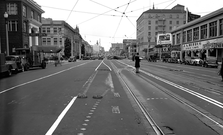
Muni, Golden Gate Transit and PresidiGO buses used to crawl along Van Ness Avenue —part of US 101— through some of the Bay Area’s densest neighborhoods at an average of just 8 mph. Its highway-like conditions also made it one of San Francisco’s most dangerous streets for fatal crashes.
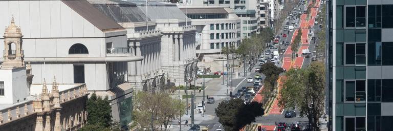
Now, with implementation of transit priority improvements on San Francisco’s first full-scale Bus Rapid Transit (BRT) corridor, those who depend on transit to travel regionally and locally to jobs and schools, like Tenderloin Community Elementary School, Galileo High School and City College, spend less time waiting at bus stops and stuck in traffic. Bus travel is up to 36% faster and 45% more reliable, and injury traffic collisions are down by 50%.
Van Ness BRT is now the fastest way to travel north-south through the heart of San Francisco, with room to expand frequency and capacity by as much as 500%, supporting our growing population and climate action goals.
With the completion of the Van Ness Improvement Project, San Francisco now has its first Bus Rapid Transit corridor, a much-needed and globally-proven solution to improve transit service on Van Ness Avenue.
Along with the most visible change, the project also included some much-needed work underground, extensive utility maintenance, civic art improvements and safety enhancements, all revitalizing this historic corridor.
Do a deep dive into some of the new features of Van Ness BRT and get to know some of the people that make this historic corridor so special by taking a virtual tour on our StoryMap.
VAN NESS BUS RAPID TRANSIT FEATURES
Bus Rapid Transit on Van Ness is a part of Muni Forward, prioritizing frequency and reliability for customers.
Some features of Bus Rapid Transit on Van Ness include:
- Dedicated transit lanes that are physically separated from the other traffic lanes, for use by public transportation buses and emergency vehicles only.
- Enhanced traffic signals optimized for north-south travel with Transit Signal Priority that gives buses the green light as they approach an intersection.
- Low-floor vehicles and all-door boarding, that make it quicker and easier for passengers to load and unload at each stop (features that Muni has across its system).
- Safety enhancements for people walking, like corner sidewalk extensions, median refuges, high visibility crosswalks and audible countdown signals.
Fully furnished boarding platforms that include shelters, seating and NextMuni prediction displays located at key transfer points.
- 已完成 (Completed)
VAN NESS BUS RAPID TRANSIT STOP LOCATIONS
The new Van Ness Bus Rapid Transit corridor features nine northbound and nine southbound boarding islands along the red, center-running transit lanes served by Muni's 49 Van Ness/Mission, 90 San Bruno Owl, and Golden Gate Transit buses.
- Union Street (Connect to the 45 Union/Stockton)
- Vallejo
- Jackson (Connect to the 12 Folsom, 27 Bryant)
- Sacramento (Connect to the 1 California, California Cable Car)
- Sutter
- Geary-O'Farrell (Connect to 38 Geary, 38R Geary Rapid)
- Eddy (Connect to the 31 Balboa)
- McAllister (Connect to the 5 Fulton, 5R Fulton Rapid)
- Market (Connect to the J Church, KT Ingleside Third, L Taraval Bus, M Ocean View, N Judah, 9 San Bruno, 9R San Bruno Rapid, 14 Mission, 14R Mission Rapid)
VAN NESS BUS RAPID TRANSIT FEATURES
Bus Rapid Transit on Van Ness is a part of Muni's Rapid Network, prioritizing frequency and reliability for customers. The improvements cut travel times on the corridor for Golden Gate Transit and Muni's 49 Van Ness/Mission and 90 San Bruno Owl buses by up to 36%.
Some features of Bus Rapid Transit on Van Ness include:
- Dedicated transit lanes that are physically separated from the other traffic lanes, for use by Muni and Golden Gate Transit buses only.
- Enhanced traffic signals optimized for north-south travel with Transit Signal Priority, which gives buses the green light as they approach an intersection.
- Low-floor vehicles and all-door boarding, that make it quicker and easier for passengers to load and unload at each stop.
- Safety enhancements for people walking like sidewalk extensions, median refuges, high visibility crosswalks and audible countdown signals.
- Fully furnished boarding platforms that include shelters, seating and NextMuni prediction displays located at key transfer points.
FUNDING
Funding for the core Van Ness Bus Rapid Transit project came from a variety of sources including FTA Small Starts, San Francisco Prop K funds and development fees.
Projects associated with Van Ness BRT, including repaving Van Ness Avenue, new traffic signals, hardware and software, new transit vehicles and streetlight/pole replacement were funded by FTA Formula Funds, San Francisco Prop K funds and regional and statewide sources.
VAN NESS AVENUE HISTORY

When it was first surveyed in 1856, Van Ness was intended to be the City’s spine. Mansions of prominent families populated the northern end while the southern had dense working-class housing. Serving as a firebreak after the 1906 earthquake, Van Ness saved the western part of the city. By the 1920s, grand auto showrooms peppering the corridor made Van Ness the west coast’s largest Auto Row. Once the Golden Gate Bridge was built, it shifted toward regional auto travel. Since the '90s, transportation plans prepared by the San Francisco County Transportation Authority and Muni recognized the need to establish rapid transit service on Van Ness Avenue. In 2003, 75 percent of voters approved the sales tax to plan rapid transit service on Van Ness Avenue. In September 2013, the Board of Supervisors, acting as the San Francisco County Transportation Authority Commission, unanimously approved the Van Ness Bus Rapid Transit Project, the core of the Van Ness Improvement Project. Construction of the project began in October 2016.
Today, the Van Ness Avenue corridor serves as a vital connector of neighborhoods and a regional link for travel between Marin, San Francisco and San Mateo Counties. Van Ness Avenue is one of the busiest north-south corridors in the city, serving over 16,000 Muni customers daily on the 49 Mission/Van Ness and 90 San Bruno Owl bus routes as well as Golden Gate Transit customers. It is part of the California State Highway System and of US Route 101, a primary artery that connects Interstate Highways 280 and 80 with the Golden Gate Bridge.
