The Twin Peaks Figure 8 Redesign Project was sponsored by San Francisco Recreation and Parks Department (RPD) in partnership with the SFMTA and San Francisco Public Works (SFPW).
Please visit the RPD's Twin Peaks Figure 8 Redesign Project Webpage for the latest project updates and information.
In July 2016, the SFMTA and the RPD implemented the Twin Peaks Pilot Promenade to test out a new configuration for Twin Peaks Boulevard. The pilot configuration was made permanent in June 2020 as RPD and SFPW continue to study long-term design solutions.
- 已完成 (Completed)
Background
Twin Peaks is a world-famous tourist destination with 64 acres of open space, is home to the endangered Mission Blue Butterfly, and has three developed trail systems: the Peaks Trail, the Mission Blue Butterfly Trail, and the Portola Trail. These trails provide public access to this undeveloped natural area.
Project Goals
- Repurpose a portion of the existing roadway from vehicle use to pedestrian and bicycle use;
- Better link pedestrian crossings with the trail sections;
- Recommend realignment of the Bay Area Ridge Trail to cross over Twin Peaks Blvd; and
- Identify opportunities to improve bicycle and pedestrian access.
Twin Peaks Pilot Promenade
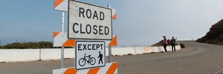
In July 2016, the SFMTA implemented a pilot project to test a new roadway configuration around Twin Peaks. The western half of the Twin Peaks "Figure 8" roadway was opened to two-way vehicle traffic, and the eastern half was opened to people walking and biking.
Twin Peaks Figure 8 Pilot Evaluation and Extension
The SFMTA recommended extending the Twin Peaks Figure 8 Pilot, which used paint and concrete barriers to designate the eastern half of the Figure 8 roadway for people walking and biking. The Pilot began in July 2016, during which time the SFMTA conducted an evaluation of the pilot configuration and collected community feedback. The number of vehicles driving over the 30 MPH speed limit dropped by 77% on the new two-way eastern half of the roadway, and through a year-long public survey, more than 58% of respondents supported making the project permanent. For more information, see the Pilot Evaluation Fact Sheet.
Based on these results, the RPD and SFPW are developing proposals for permanent changes to the Twin Peaks Figure 8. The pilot project configuration was made permanent in June 2020 allowing time to continue to explore further design options. During this time, RPD and SFPW will work to complete the following:
- Develop illustrative renderings for a converted roadway;
- Host a public open house to share design renderings with the community and solicit input;
- Finalize concept design and cost estimate;
- Complete environmental review of the design;
- Work on street vacation legislation and jurisdictional transfer; and
- Pursue funding for construction
