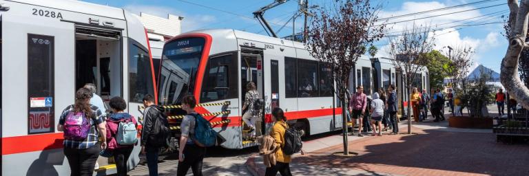
三藩市的西區在行動中 通過安全、方便及無障礙的交通方式建立聯繫
As San Francisco continues to grow, numerous city projects help us adapt to increasing needs and changing conditions and improve aging infrastructure. Projects in San Francisco’s westside neighborhoods – Sunset, Parkside, Richmond and others – will upgrade infrastructure, increase road safety, transit reliability and traffic flows, and add safe non-motorized travel options and create opportunities for more people and families to enjoy physical activity in the city’s open space.
From the health of our sewer and water systems to the public health of our communities, the city’s westside projects are helping make San Francisco safer, connected and ultimately more functional and resilient for more people long-term while also supporting the changed ways that people get out and get around.

Long-term Goals and Policies
San Francisco’s westside projects serve the city’s overarching, long-term goals as a Transit First, Vision Zero city. This means
- Prioritizing transit as a primary mode of travel throughout the city
- Reducing road crash injuries and deaths
- Connecting residents to open space
- Creating safe multimodal networks for all residents and visitors
- Creating resilient infrastructure and communities
- Creating a safe and well-connected network for bicyclists and pedestrians
Some projects are led by the SFMTA. In other cases, the SFMTA is a partner agency, supporting aspects of the project led by another city agency such as the San Francisco Recreation and Park Department (Rec and Park), San Francisco Public Works (Public Works), or the San Francisco County Transportation Authority (Transportation Authority).
There are numerous policies, plans and studies that inform current and future work on the westside. These include, but are not limited to:
- Vision Zero
- San Francisco’s Transit First policy
- ConnectSF
- Agency strategic plans such as the SFMTA Strategic Plan and the Rec and Park Strategic Plan
- The Ocean Beach Master Plan
- The District 4 Mobility Study, led by the San Francisco County Transportation Authority
These policies, plans and studies address long-term increasing demands on our roads, aging infrastructure, changing demographics and critical climate change impacts along our coast from water level rise and beachhead erosion.
To make sure we can continue to meet the needs of all communities throughout San Francisco for years to come, the city is working to connect people to open space, advance much-needed traffic improvements on the westside and adapt our streets to provide more options for non-motorized travel and transit efficiency while improving safety, infrastructure and traffic flows, and serving the city’s long-term health, mobility and environmental goals.
As we make these investments, we are also working to ensure that westside residents who need to drive can continue to do so, and that we address gridlock, dynamic traffic patterns and safety and accessibility for all users. In summary, this is a unique opportunity to advance much-needed traffic improvements on the westside.

What Westside Projects Aim to Achieve
- Safer roads for all
- Faster and more reliable transit
- More opportunities for safe non-motorized travel
- More transformative, vibrant, accessible open spaces
- Improved recreational opportunities and public health outcomes for all residents
- Long-term climate resilience, specifically adapting coastal infrastructure to respond to pervasive coastal erosion
- Improved neighborhood connectivity
Actions the SFMTA is Taking
- Working in partnership with District 1, District 4, and District 7 to support opportunities and challenges in a coordinated way
- Working to improve traffic flows and neighborhood connections, including:
- Evaluating and monitoring the collective impacts of car-free streets and improvement projects
-
- Analyzing intersections and streets – like Sunset Boulevard, Lincoln Way, and Fulton Street –where we can make changes quickly to improve traffic flows within and between the Sunset and Richmond.
- Improving key intersections such as Lincoln and the Great Highway
- Continuing our outreach and engagement among the community to keep neighbors better informed of all our local projects, traffic impacts and mitigation efforts.
- Balancing competing needs and priorities, including the city’s long-term goals for transit, climate resilience and public health and public coastal access
Active Westside Projects and Benefits
Improving transit efficiency and reliability for faster, smoother, more on-time rides and providing more opportunities for community members to use streets for biking and walking safely throughout the westside.
Below is a map showing some of the projects impacting travel, access and multimodal mobility to and from westside neighborhoods. For more detailed information on projects affecting the westside, please see the "Related Content" column on the right side of the page.
Graphic: *Map of projects impacting the westside neighborhoods"
Key corridors in San Francisco today continue to operate with similar or less congestion as before COVID, including Sunset Boulevard and 19th Avenue.
To see current traffic congestion data throughout the city, visit the San Francisco Transportation Authority’s COVID Congestion tracker. Data is updated frequently.
Share Your Feedback
We understand that city projects that advance city-wide goals and support a complex, multimodal system also come with some disruptions. We want to try to help you navigate the projects a little easier by sharing information you can use.
How can we keep you better informed about the projects that are happening in San Francisco’s westside neighborhoods, their impacts and benefits?
To share project-specific feedback please email the project contact listed above.
To share general feedback please use our Muni Feedback Form or call 311 and ask for Muni Customer Service.


