Introduction
The SFMTA must quickly reduce harmful emissions generated by the city’s transportation sector while simultaneously building a more resilient multimodal transportation system that can withstand hazards associated with seismic and climate events. In the San Francisco Bay Area, climate change has manifested as torrential downpours, accelerated rates of sea level rise, hurricane-level winds, heat waves and wildfires, which are projected to worsen in the years ahead unless emissions are drastically reduced. Recent flood events have impacted the Embarcadero corridor and critical facilities such as SFMTA’s Islais Creek Facility, while chronic coastal erosion has impacted the Great Highway extension south of Sloat Boulevard. To increase the resiliency of the multimodal transportation system to future climate impacts, the SFMTA is working with partners across the city, Bay Area, and state on a variety of transportation projects.
Current Adaptation and Resilience Efforts
Adapting our infrastructure and transportation networks to be more resilient is an increasingly critical task for the agency and city. Climate adaptation and resilience programs provide important benefits, including safety improvements for people bicycling and walking, infrastructure upgrades, improved transit reliability, more equitable access to resources and economic vitality. The SFMTA is collaborating with partner agencies and local stakeholders on several projects throughout the city that are critical to protecting our local transportation infrastructure in the face of future hazards.
The Port-led Waterfront Resilience Program prepares the city’s waterfront from Fisherman’s Wharf to Heron’s Head for seismic and flood risk through the end of the century. In conjunction with the United States Army Corps of Engineers’ San Francisco Waterfront Coastal Flood Study, the Waterfront Resilience Program is developing strategies to make the city’s waterfront more resilient in the face of seismic and climate risks. The SFMTA is using the Waterfront Resiliency Transportation Assessment to evaluate the impacts of these various strategies on the city’s transportation network and facilities and to inform the recommendations of the Waterfront Resilience Program and Flood Study. Leading scenarios include raising the shoreline, critical bridges, certain waterfront buildings and some portion of roadways and transit and utility infrastructure to address up to seven feet of sea level rise by the end of the century.
Current SFMTA projects such as the Embarcadero Enhancement Program involve near-term improvements that integrate anticipated long-term transformations along this corridor. Upcoming projects like the Embarcadero Mobility Resilience Plan will follow seamlessly in the footsteps of the Waterfront Resilience Program and Flood Study by identifying specific transportation projects and investments that protect critical local, regional and state transportation infrastructure and are integrated with the city’s resilient shoreline.
On the west side of the city, the SFMTA is working with partners to implement key pieces of the Ocean Beach Master Plan. The “Key Moves” from the plan will increase climate resilience, adapt to sea level rise and coastal erosion, and improve safety, access and connectivity along Ocean Beach. The SFMTA is actively installing signals and investing in multimodal improvements along key corridors such as Sloat Boulevard.

San Francisco Risk Assessments
Over the past decade, the SFMTA and our partners, including the Port of San Francisco and SF Planning, have assessed the risks that sea level rise poses to key transportation assets along the Bay shoreline and Ocean Beach. The city has used these assessments to inform targeted climate adaptation planning to address specific issues or locations in the city.
- Sea Level Rise Action Plan (2016)
- Sea Level Rise Vulnerability and Consequences Assessment (Ch. 5 - Transportation) (2020)
- Multi-Hazard Risk Assessment (2020) (by Port for Northern Waterfront)
- Hazards and Climate Resilience Plan (2020)
- Islais Creek Adaptation Strategy (2021)
Regional and Statewide Collaboration
The SFMTA partners with regional and state entities to ensure alignment with peer planning efforts. The 2021 California Climate Adaptation Strategy links state adaptation efforts and identifies six resilience priorities in a regional report focused on the San Francisco Bay Area. San Francisco partners with the state to address climate impacts to transportation infrastructure and recently won funds through the Caltrans Climate Adaptation Planning program. The SFMTA is tracking the development of Caltrans’ State Climate Resilience Improvement Plan for Transportation (SCRIPT), which will include a list of priority projects. Bay Area partners such as the Bay Conservation and Development Commission (BCDC) have created regional resources with guidance for sea level rise adaptation, including the Bay Adapt Joint Platform and the San Francisco Bay Plan Climate Change Policy Guidance. As part of the region’s long-range transportation planning process, Plan Bay Area, the Metropolitan Transportation Commission and Association of Bay Area Governments produced a Sea Level Rise Adaptation Funding & Investment Framework that the SFMTA and the city have commented on and shared project information for.
On the Horizon
Additional funding is needed for further adaptation planning and to make the necessary changes to our transportation system. New partnerships and opportunities for innovation will be explored. The SFMTA is coordinating efforts to increase the overall resilience of San Francisco’s transportation system by using a comprehensive adaptation program to manage the risks posed by climate impacts and natural hazards in a cost-effective way.
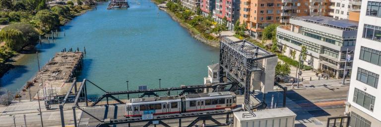
Note: Top photo by Jim Maurer (CC BY-NC-ND 2.0).
